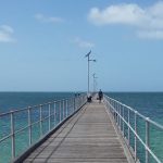
Jonathan has been hauling in the squid from the jetties and caught his biggest yet in Ceduna.
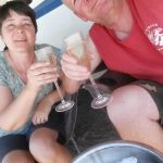
The oysters along the West Coast are said to have a range of flavours so we thought it would only be right to try some from each of the four main growing areas. Armed with an oyster knife and a handy guide to shucking, we started off with a dozen from the Ceduna Oyster Bar and A One Oysters at the Smoky Bay oyster sheds.
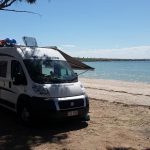
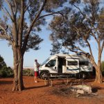
The wind had dropped, the sun was shining and we were camped up on the beach. It didn’t get much better than that.
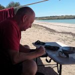
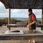
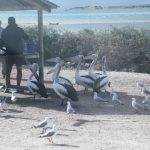
Our next dozen came from the Streaky Bay Seafood company. These made a very tasty lunch with some fresh buttered bread. Jonathan caught an Australian Salmon from the jetty at Venus Bay and we ate that for dinner, battered, with some chips from the nearby café. Winston did a sterling job keeping the pelicans and seagulls away from the fish cleaning table.
We’re becoming pescetarians (I think that’s the correct term).
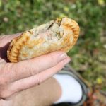
At Coffin Bay, we tried the Pacific Oyster and also an Oyster Pie from the local bakery, which was quite tasty.
In our opinion the oysters from Streaky Bay and Coffin Bay tasted best straight from the shell with a squeeze of lemon juice or garlic butter. They were fresh, sweet and light. The larger oysters from Ceduna and Smoky Bay had a stronger flavour with a distinct saltiness and were very tasty cooked. We grilled some Kilpatrick style with bacon and Worcestershire sauce and also deep fried some in batter. We still need to try the native Angasi oyster which is said to be very rich, with a meaty flavour and texture.
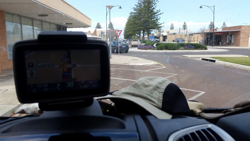
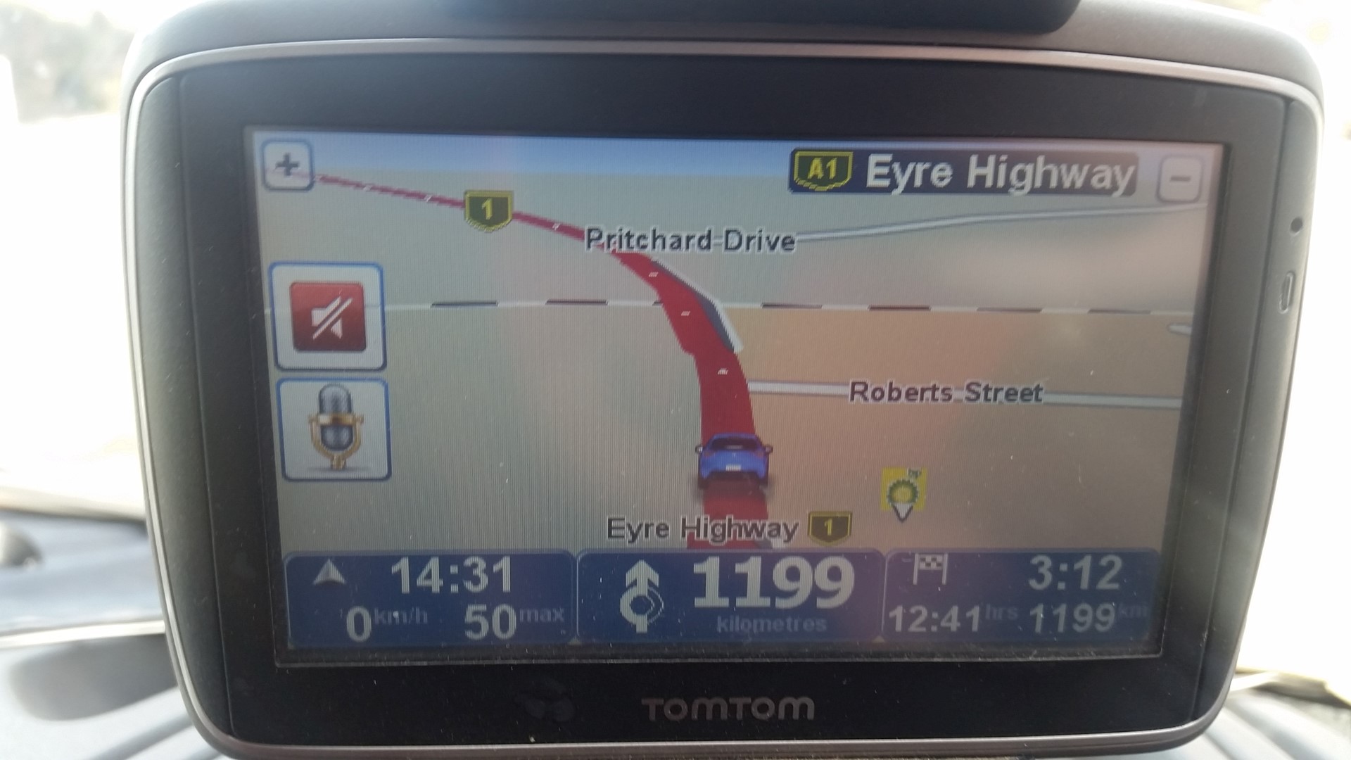
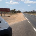
After a 1200km drive across the Nullarbor, we arrived at Ceduna and performed the manoeuvre at the roundabout.
From here, you can either drive directly across to Port Augusta or you can tour the Eyre Peninsula. The Peninsula is famous for its seafood, particularly oysters, so we weren’t going to miss out on that. Ceduna itself is a small, quiet, seaside town but you can’t help noticing there’s a large court house, a domestic violence unit, a relationship centre and the caravan park has a security fence.
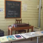
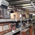
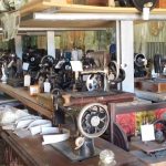
I spent some time at the National Trust Museum which should get an award for packing the most exhibits into the smallest space. It has rooms full of radios, sewing machines, typewriters, stuffed birds, household appliances; sheds full of farm machinery and vehicles; a school building, a relocated cottage to name a fraction.
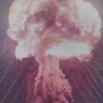
One particularly interesting room had displays about the Atomic testing carried out by the British in the 1950’s at Maralinga which is 400km NW of Ceduna This seems to be a largely unknown part of Australian history. At the time, the town housed 550 British and Australian nuclear scientists, technicians and Army and Air Force personnel. There were 7 major weapon tests at Maralinga and hundreds of ‘minor’ trials including radiological experiments which scattered long-lived plutonium over a large area. There were long term health issues for service personnel and the local communities. For example pilots were told to fly through the toxic clouds to gather data.
The site was cleaned up in the late 90’s and now there are 3-day tours out to the testing grounds where you can explore the remaining infrastructure and visit the burial pits where all the contaminated equipment was buried. We decided to pass on this one.
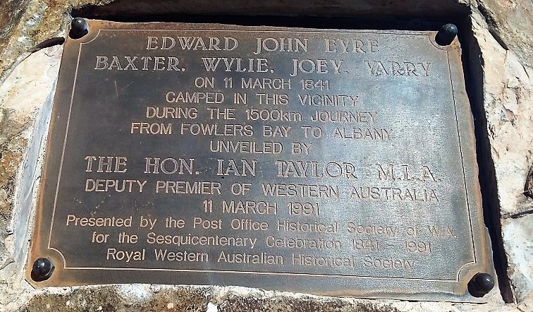
The Eyre Highway is named after Edward John Eyre, an English born explorer who was the first European to cross the Nullarbor Plain in 1840-41. There are various plaques commemorating his achievement along the way.
Tragically, just six weeks after they camped near this spot at Eucla; Joey and Yarry murdered Baxter, stole all the supplies and ran off. Eyre and Whylie only survived when they came across a French whaling ship near Esperance. Over 175 years later, it’s still pretty difficult to get supplies while travelling across the Nullarbor.
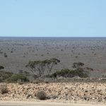
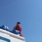
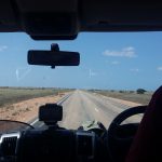
After a long featureless drive (the Nullarbor does mean ‘no trees’ after all), it was a surprise to reach the Madura Pass where there are spectacular views across the plains. Climbing on top of the van made for a better photo.
There is a news article at the museum in Eucla, written by a traveller driving across the Nullarbor in his Holden in August 1953 who stopped at Madura to refuel: “I boiled my billy in the skimpy shade of a sandalwood tree, chewed some chops and pushed on another 180 miles of monotony to Balladonia.” This could have been us, except we had cake. I can’t imagine what it must have been like driving all that way before the highway was sealed, let alone setting out into the unknown in the 1840s.
Jonathan was keen to stop at Mundrabilla as Australia’s biggest meteorite was discovered nearby, which weighed over 10 tonnes. There was no mention of it anywhere though.
Night 3, we stopped at Eucla, which is 12km from the SA border, to spend our last night in WA We’ve been exploring WA for over 3 months which shows how big it is. The van park is high on the range and we camped up in a glorious spot overlooking the ocean and plains below. We soon had the chairs out and were enjoying the warm afternoon sun and views with a glass of wine.
Eucla Caravan Park
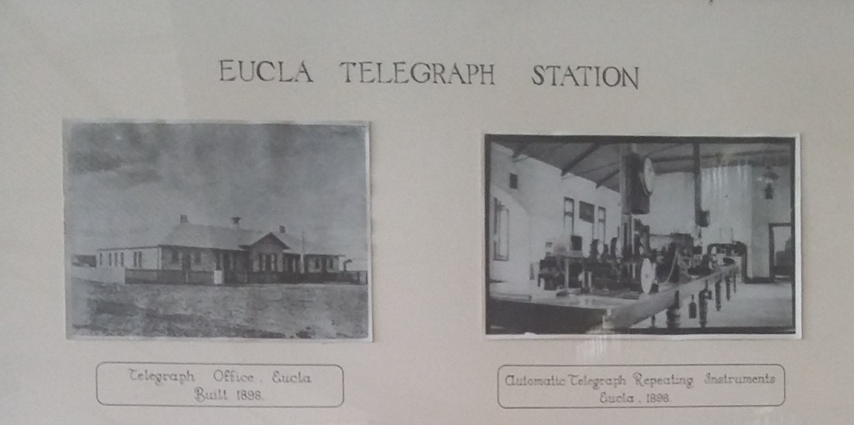
In the early 1900s, Eucla was a busy telegraph station. The first message sent to Perth on 8th December 1877 was ‘Eucla line opened. Hurrah’. The station now lies in ruins and buried in the sands.
Today, Eucla seems to have the best phone reception along the Nullarbor and we were able to have a long Skype chat with video to my sister and brother in law in the UK, with no connection issues at all.
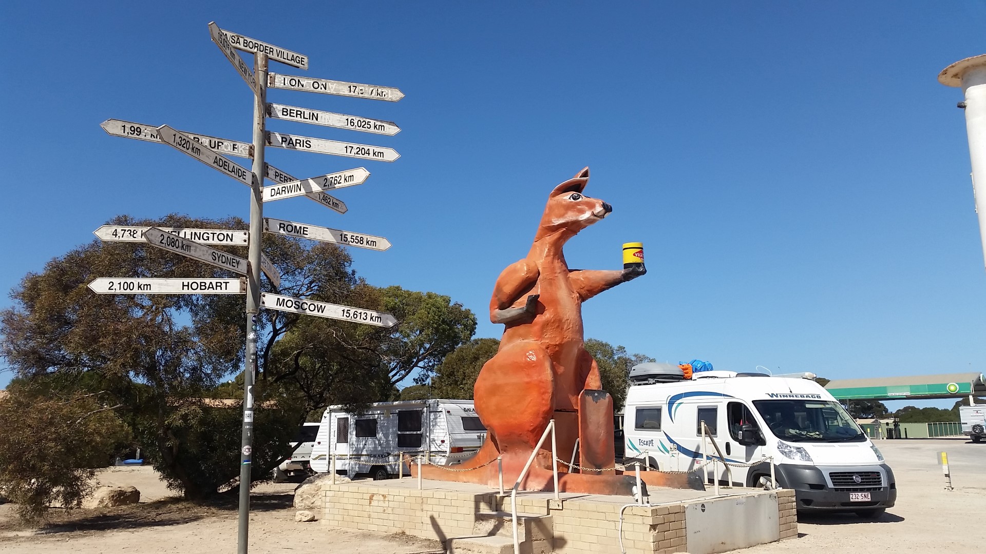
Goodbye WA
We were back in South Australia soon after setting off the next morning. If you’re travelling West, there’s a quarantine checkpoint here. A big kangaroo holding a jar of vegemite marks the border crossing.
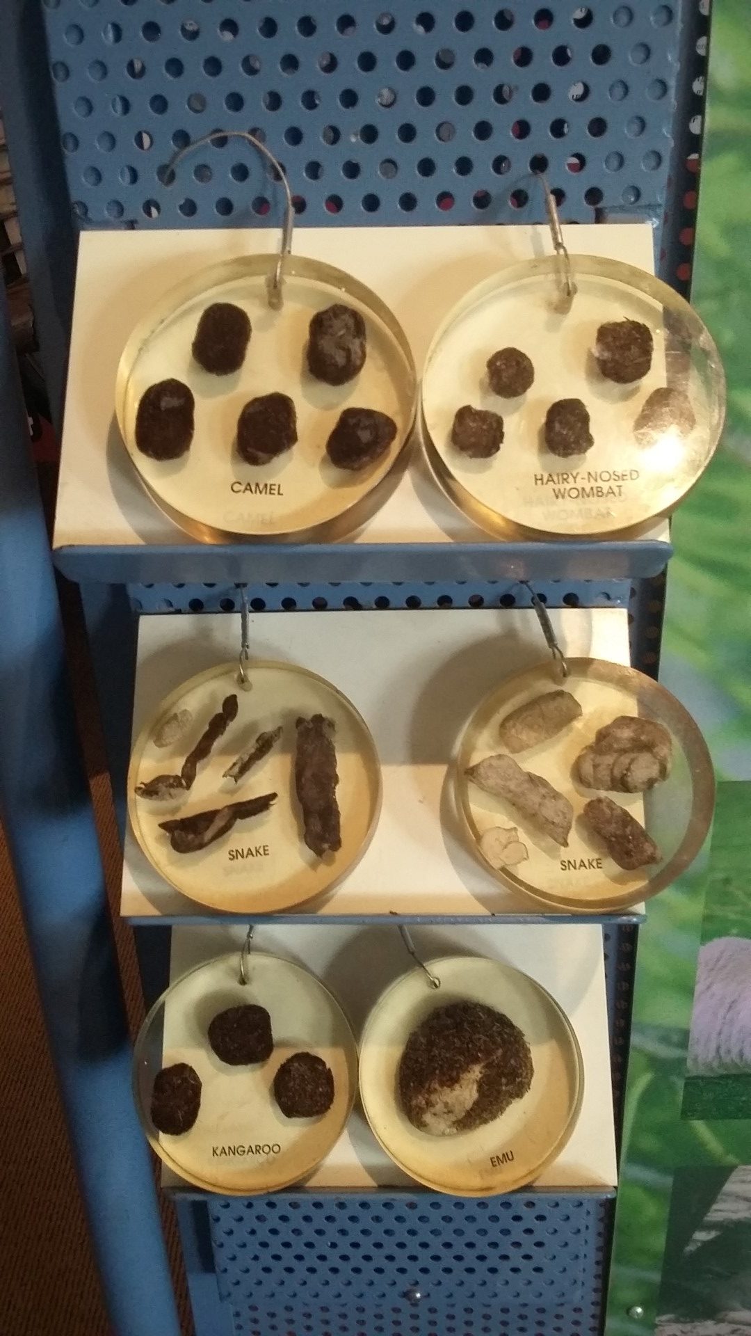
Only saw a few roadkill roosHandy poo recognition display Balladonia museum
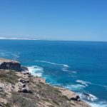
The Great Australian Bight
For the next 150km, the highway runs alongside the Great Australian Bight. There are four lookouts along this stretch. Number 2 made for a scenic morning tea stop.
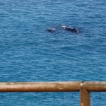
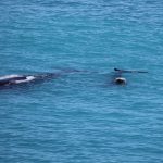
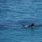
The Head of Bight is the best place to see Southern Right Whales between June and October. The females come into the sheltered waters to give birth and then spend some time there with their calves. The road down to the ‘interpretative centre’ is sealed. There is a $15 entry fee per adult to go through to the lookouts. We did see whales at the other lookouts, high up on the cliffs but this was worth it as the boardwalk takes you down the cliffs and there were five mothers with their calves close to shore.
Fowler’s Bay
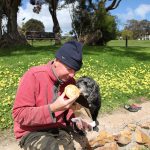
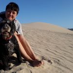
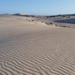
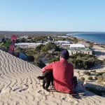
A little fishing village, south west of Ceduna which sounded the perfect place to spend a lazy day and plan the next stage of our trip. It was sunny and warm but the gusty winds blasted you with sand and made walking a bit challenging. It was fun walking amongst the dunes. Jonathan caught quite a haul of squid from the jetty.
The Eyre Highway which crosses the Nullarbor Plain is either seen as one of Australia’s great road journeys or one of its most boring. The town of Norseman, 190km South of Kalgoorlie is the gateway to the crossing in the West and it’s a journey of 1200km to Ceduna in South Australia. As we set off, our GPS told us that our next manoeuvre would be a roundabout in Ceduna.
We had been free camping for four days as the weather was perfect but Tuesday was forecast to reach 35 degrees. We’ve learned to adjust the times we travel so that we’re driving with the air con on during the hottest part of the day. The first night we stopped at Fraser Range Station which was a very pleasant and scenic stop.
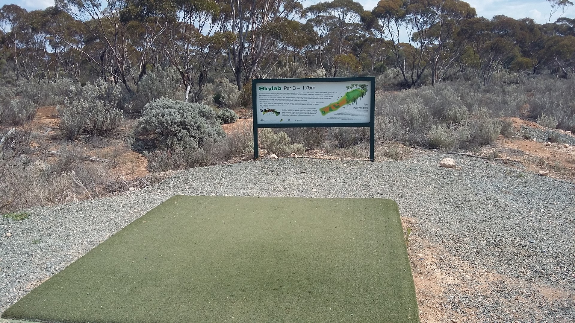
There’s not too much to stop and see along the first part of the highway. One interesting place is Balladonia. In 1979 it made the news when debris from Skylab fell close to the town. The Shire decided to issue a litter infringement notice to NASA (which was later written off).
The Nullarbor Links is the world’s longest golf course. It starts at Kalgoorlie or Ceduna and there are holes at various points along the Eyre Highway, mostly at roadhouses. We didn’t bring our clubs with us but there were plenty of people who were working their way along the course. You can buy a golf score card for about $70 at visitor information centres in Kalgoorlie, Norseman or Ceduna.
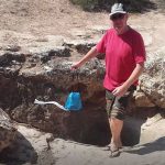
Just outside of Balladonia is the start of Australia’s longest straight road. At Caiguna, at the other end was a very interesting blow hole which was like a natural air conditioner. It was a hot day and we would have sat near it for lunch if there hadn’t been millions of flies around.
Jonathan demonstrating the blow hole
You also have to put your clocks forward by 45 minutes at Caiguna. This seemed to make life confusing for everyone at Cocklebiddy a bit further on where they had ‘Perth time’, ‘Cocklebiddy time’ and ‘Adelaide time’. We were ready to call it a day at Cocklebiddy even if we weren’t sure what time it was. The van park at the roadhouse is enormous and was empty apart from two vans. We had to scratch our head at the manager who decided he wanted to put us between a smelly fuel container and a noisy generator. I very politely told him no thank you.
(By the way, no photos of me today as I was bitten on the eyelid by a mosquito in the night and don’t look my best!!)
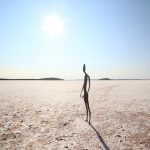
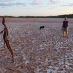
There always seems to be something tempting us a bit further off our planned route. We didn’t regret a trip out to Lake Ballard, a salt lake 51km West of the town of Menzies though. The Perth International Art Festival commissioned sculptor Antony Gormley to create the ‘Inside Australia’ art installation for their 50th anniversary in 2003.
He set up a 3D body scanner in Menzies Town Hall and managed to persuade 51 locals to strip naked in order to have their bodies ‘mapped’ by the scanner. It was one used by the film industry to create animation and special effects. He then used the images to create 51 metal figures which he set out across the huge salt lake. The names of all the residents are listed on the website at www.lakeballard.com
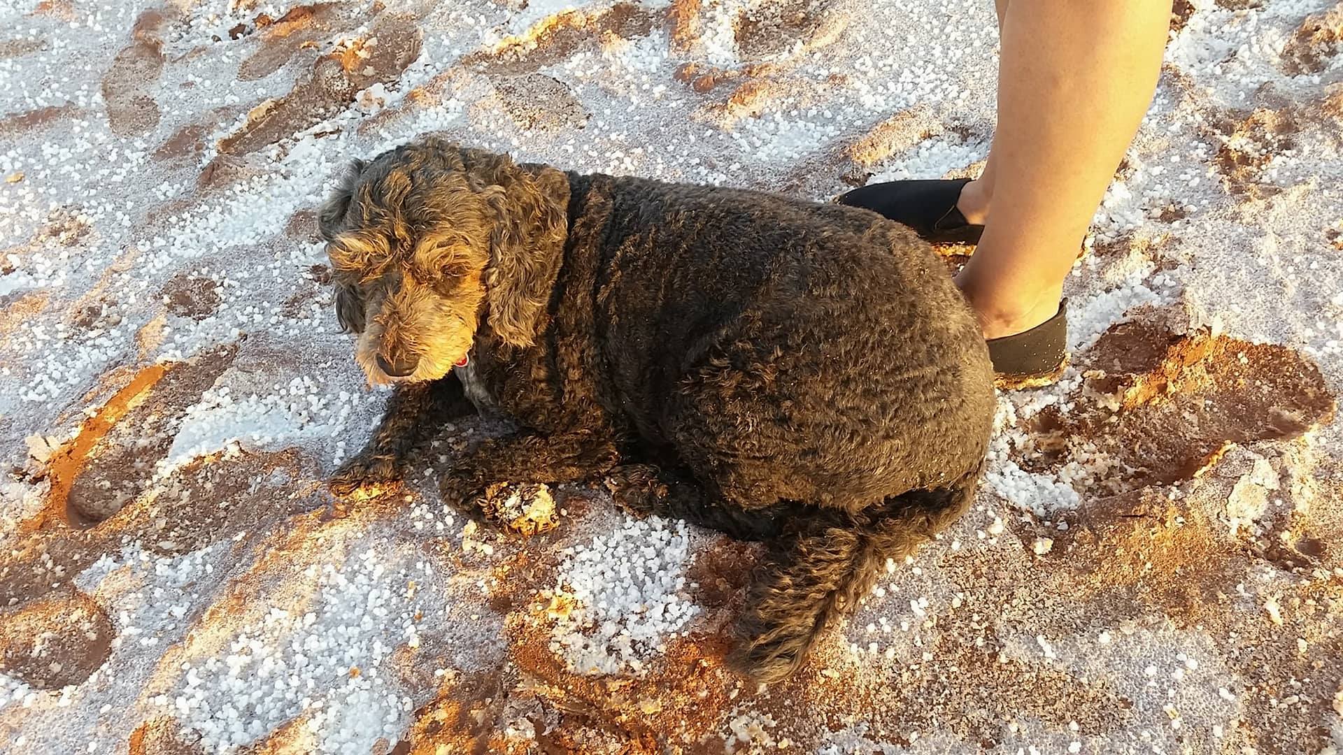
There is a free camping area beside the lake in a beautiful bushland setting with lots of wildflowers and there’s also plenty of shade. It was the most peaceful, relaxing campsite we’ve stayed at so far and we were the only ones there for most of the time. The only amenities are picnic benches, fire pits, rubbish bins, a long drop and a dump point. There’s no phone reception at the Lake.
Due to recent rains, the surface of the lake was slippery red mud and quite difficult to walk on. Some visitors had brought some $3 shoes with them specifically to wear out on the lake and leave behind for others. Luckily a pair fitted me which saved my shoes.
Jonathan was keeping his fingers crossed for clear night skies so he could take an astro photo. While the skies weren’t as good as they could be, he still took some impressive photos.
The council are in the process of sealing the road to the lake but the 30km of unsealed road was well graded and not an issue for the campervan. The only downside to the experience were the huge march flies which didn’t seem to be put off by insect repellent.
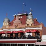
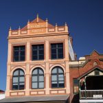
We were planning to start our drive across the Nullarbor once we left Esperance but decided to detour north to see the gold mining twin towns of Kalgoorlie-Boulder. The Goldrush began in 1893 after three down on their luck Irishmen stumbled upon some gold nuggets and registered a claim. You can see the incredible wealth of the towns at the height of the gold rush in the architecture of the main streets.
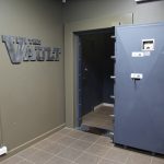
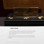
At the museum, local man Geoff does an excellent tour at 10.30am, bringing alive the history of the area and the people. Hear tales of famous gold nugget finds and see a display worth millions of dollars kept behind bullet proof glass in The Vault.
See the pub where the death of a local miner in 1934 sparked the worst riot on the goldfields. Look out for the ghost of a woman who fell down the stairs in the museum building in the early 1900s. Find out how a young miner was rescued by early divers after being trapped in a flooded mine for 9 days in 1907.
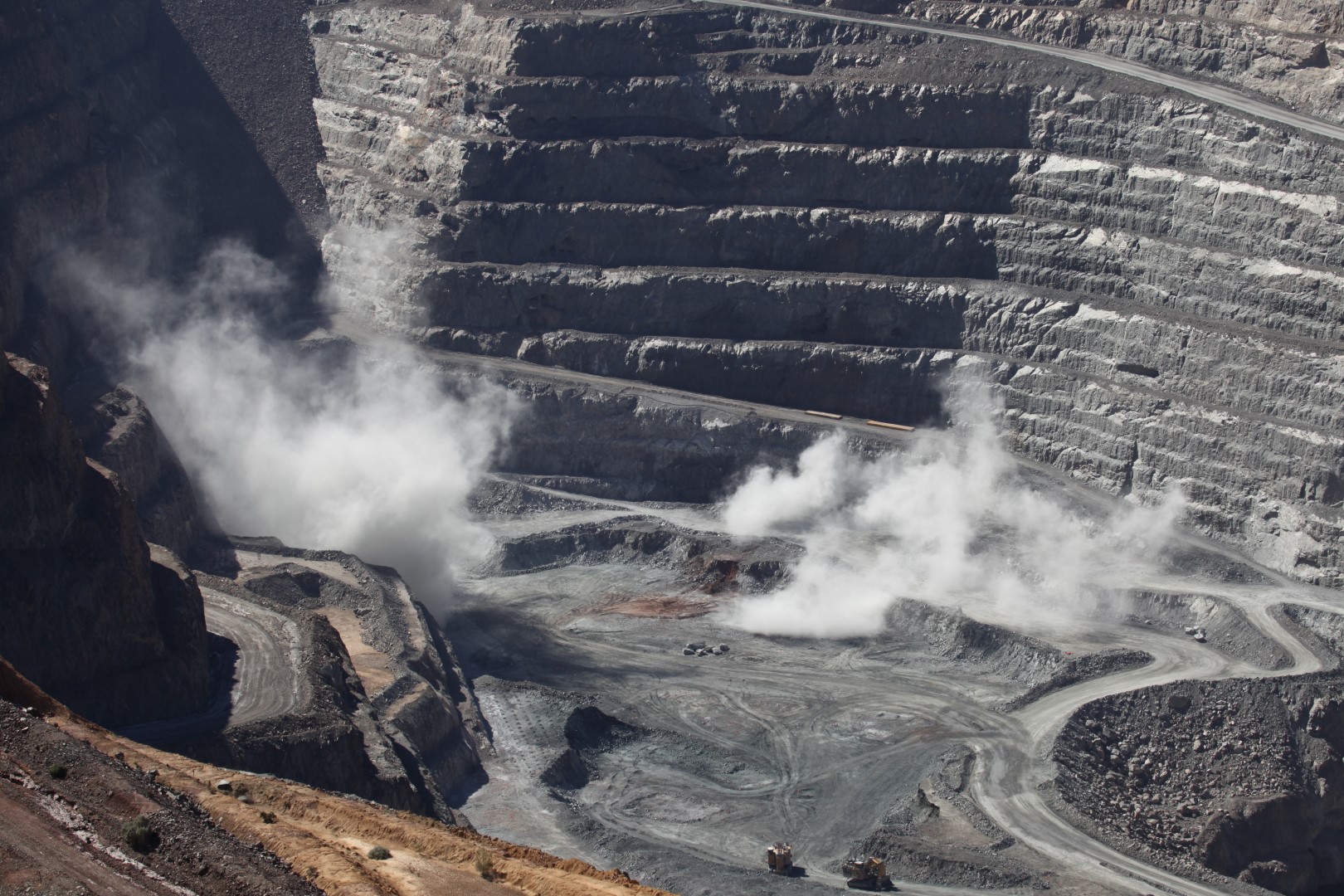
Jonathan went on a 2 1/2 hour tour of the Fimiston Open Pit, known as ‘The Super Pit’ a working gold mine. The tour bus goes down into the mine and drives amongst the huge trucks and mine workings. The daily blasts can be viewed from the lookout. The pit is approximately 3.5 kilometres long, 1.5 kilometres wide and over 600 metres deep.
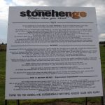
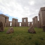
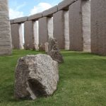
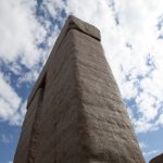
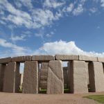
Who’d have thought there’s a life size replica of Stonehenge as it would have first looked, on the WA south coast, just outside of Esperance. We used to live in Wiltshire in the UK and Jonathan drove past the real Stonehenge every day on his way to work, so we had to visit. Someone’s mad idea of a tourist attraction that could be built from the local pink granite. It sits in the middle of a cattle farm with views across to Esperance Bay. It could have been yours to own for $5 million recently.
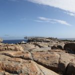
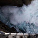
The Gap and the Natural Bridge demonstrate the power of the crashing waves of the Great Southern Ocean on the granite rocks.
A cantilevered lookout was recently completed which extends 10 metres out over The Gap. It probably wasn’t a good idea reading the information board about how challenging the lookout was to build due to the instability of the rocks, before walking out on to the lookout.
The Gap
The Natural Bridge is a short distance from The Gap.
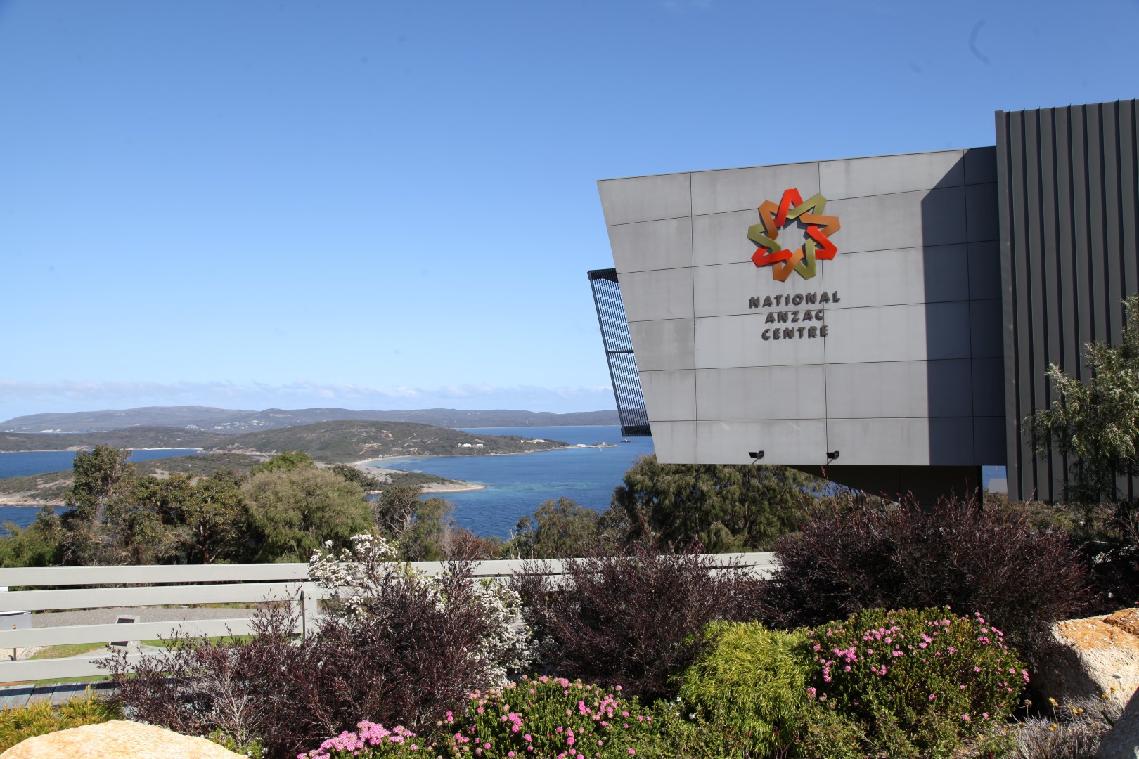
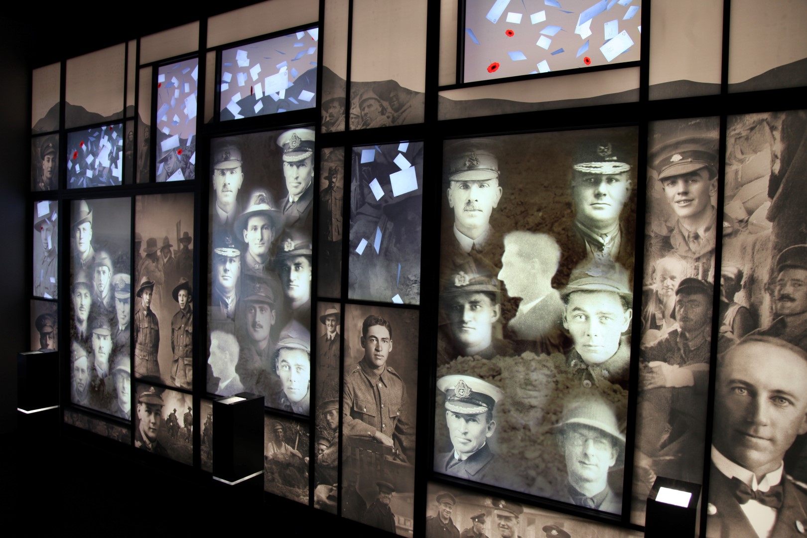
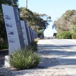
The centre overlooks King George Sound where two convoys departed for the battlefields of the First World War. It was opened on 1st November 2014 to coincide with the centenary of the departure of the first convoy.
Through interactive displays, it tells the stories of soldiers, nurses, army chaplains, surgeons, war correspondents, photographers and even the horses who left in the convoys. You are given a card at the entrance which lets you follow the story of one particular person, from embarkation to the end of the war, when you find out if they returned home.
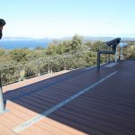
An amazing amount of thought has gone into the design of the building and the exhibition to take advantage of its position. The pool of reflections is a quiet room for visitors to sit and contemplate whilst looking out across the bay. The names of all the men and women who left on the conveys slowly move across the screen underneath the water. For thousands on those ships, it was the last time they would see Australia.
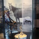
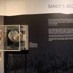
Thousands of horses were sent across with the convoys but only one Australian horse returned home – Sandy, who was the mount of Major General Sir William Bridges. When Sandy died in 1923, his head and hooves were mounted and his head can be seen at the Australian War Memorial in Canberra.
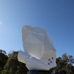
The Convoy Walk leads up to a lookout and information boards along the walk provide details about all the ships in the convoys. At the start of the walk is a sculpture of a torn and crumpled letter and scripts from original letters and postcards written during the war.
The centre is within the grounds of Princess Royal Fortress which was built to protect the shores in times of war.
You could easily spend a whole day at the complex. The entrance fee for the centre is $24 but everything else is free.