West Coast Wilderness

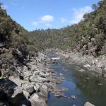
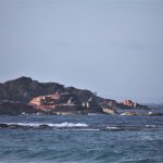
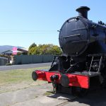
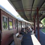
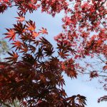
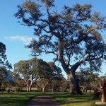
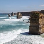
We weren’t entirely sure whether to explore the western side of Tasmania on this trip.  We couldn’t visit the big draw card of Cradle Mountain as it’s in a National Park; the roads are mostly narrow and winding and the best way to appreciate the rugged landscape is either on a cruise, a helicopter flight or a railway journey through the rainforest.  We heard that if you wanted to see the edge of the world then you should visit the West Coast so that persuaded us.

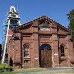
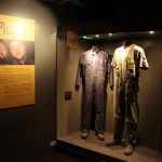
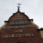
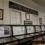
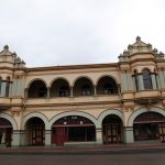
Zeehan was Tasmania’s third largest town at its height in the late 19th century after silver and lead deposits were found there and its population peaked at 10,000 around 1910 (ten times the current population).   It was known as the Silver City while the boom lasted.  The significance of the town can be seen on the main street.  The West Coast Heritage Centre has preserved and restored some of the historic buildings and is housed in the former Zeehan School of Mines and Metallurgy.  It was well worth the $25 entrance fee.

We were told by a local that Zeehan’s annual rainfall is 3 metres!

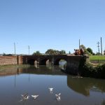
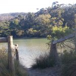
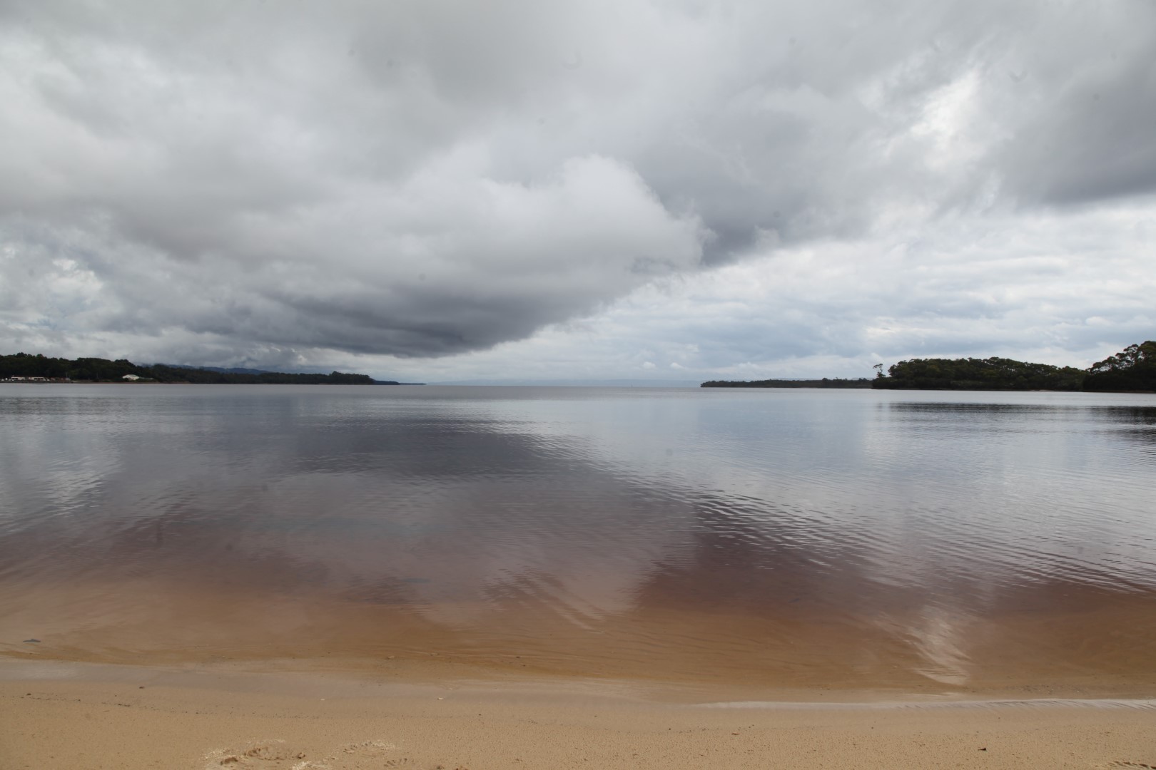
The largest coastal town is Strahan on Macquarie Harbour.  Wilderness cruises take tourists out to Sarah Island which was used as a penal settlement in the early 19th century.  The convicts were made to fell Huon pines for boat building and conditions were harsh.  Convicts called the mouth of the harbour ‘Hell’s Gates’ as they felt they were entering Hell.

Strahan

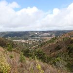
The copper smelting process at Queenstown resulted in the destruction of the surrounding vegetation which has only begun to grow back in recent years.  A friend who lived in Queenstown for 12 months said he only saw the sun for three days and it was pouring with rain when we arrived.

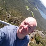
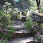
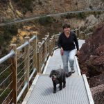
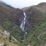
The Horsetail Falls walking track near Queenstown has only been open a few weeks.  It’s an impressive feat of engineering, clinging to the side of the cliff face and takes around 30 minutes return.  It was constructed as part of the $2.47 million West Coast rescue package by the State Government after the closure of the Mt Lyell Mine in 2014.

Winston and I did try to bail out two thirds of the way up but Jonathan encouraged us on to the top.  Miraculously, the sun came out for our walk.

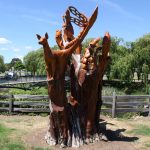
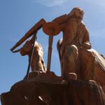
‘The Wall’ – Derwent Bridge

Everywhere we went, people told us we must see ‘The Wall’.  Over the past decade, artist Greg Duncan has carved three metre high panels out of Huon pine which tell the story of the Central Highlands region.  It’s located inside his gallery and was certainly impressive.  For the $15 entry fee, I would like to have seen other works displayed in the gallery though.  There was no photography allowed.

Tamar Valley

Beaconsfield Mine and Heritage Centre

Gold was first discovered in Beaconsfield in 1847 and led to a gold rush to the town.   It was the mine collapse in April 2006 that brought the town to the world’s attention again.  The Mine Rescue exhibition tells the story of the rescue of miners Todd Russell and Brant Webb.   Visitors can experience the conditions of the underground tomb where the miners waited for two weeks to be rescued.   The exhibition also tells how the town coped with the focus of the world’s media on them.

It seemed a shame though that there wasn’t equal weight given to the fact that there were three miners trapped and Larry Knight was killed in the rock fall.

The museum also houses several local collections including an impressive display of wooden knobs donated by Mr Ray Porter of Beaconsfield made from over 150 different types of timber.


Seahorse World, Beauty Point

If you like seahorses then this is the place for you.  It’s advertised as Australia’s only working seahorse farm which sounds a bit strange – you imagine them pulling little tractors!  There are very informative hourly tours which end at their aquarium where you can hold a seahorse in your hand.  They’re very wriggly though and I couldn’t hang on to mine.

Seahorse facts:

*the Latin name for the seahorse is Hippocampus.

*the males carry the young

*after being born, the babies (known as fry) are on their own.

*baby seahorses eat sea monkeys

*seahorses can change colour to match their surroundings.


North East Tassie

Launceston (pronounced ‘Lon-ceston’) is Tasmania’s second biggest city after Hobart.  Its main tourist attraction is Cataract Gorge Reserve which unfortunately is not dog friendly so we took turns having a look in.

Cressy – the fly fishing capital of Tasmania

Cressy is host to the Tasmanian Trout Expo every September.  It’s a shame we weren’t here then as Jonathan might have landed a $10,000 trout.  Cressy sits on the Macquarie River and is also close to Brumby’s Creek and weirs which are regarded as some of the best trout fishing spots in Tasmania.   Jonathan caught a couple of rainbow trout in the Macquarie River.  He’s becoming an expert trout filleter too and we had rainbow and brown trout fillets for dinner to compare the two.

Campbell Town

There were some beautiful sculptures next to the bridge carved by Eddie Freeman from Ross.  One depicted Dr William Valentine and his telescope.  He was responsible for the US Naval observatory team who observed the Transit of Venus at Campbell Town in 1874.

Westbury

This historic town has several National Trust buildings and a very English feel to it.  It even has a village green complete with stocks.

Bay of Fires, NE Tasmania

We found another fabulous free campsite at Swimcart Beach on the Bay of Fires and we managed to get a spot with direct beach access.  I thought the bay probably got its name from the bright orange lichen on the granite boulders but apparently it was named by Captain Tobias Furneaux who saw the fires of the Aboriginal people on the beaches in 1773 as he explored the coast of Van Diemen’s Land.

I can imagine this campsite will be absolutely packed over the summer.

Cockle Creek

Our stay at Cockle Creek is a good example of the highs and lows of travelling.  Cockle Creek is the most southerly campsite in Australia and we found a perfect spot to park up.  It was the warmest day so far in Tassie at 29 degrees and we were hotter than Cairns, Brisbane and Alice Springs.  There were oysters and mussels on the rocks and Jonathan used his geology hammer to harvest some for dinner.  Winston enjoyed swimming in the creek and running on the beach.

After a fabulous day, we set off back to Hobart the next morning only to get a flat tyre 10km out of Cockle Creek.  A lovely local couple stopped to assist with a tyre change and we were on our way again an hour later.

We spent the afternoon on a quest to get some new tyres and TyreRight in Hobart managed to sort us out.  While we were waiting, we went to the Electoral Commission office and cast our votes for the upcoming Queensland elections.

In other voting news today, the results of the same sex marriage survey were announced and 61.6% of Australians voted for the law to be changed to allow same sex couples to marry.  Many landmark buildings around Australia were lit up in rainbow colours to mark the occasion.

Margate

We camped at the Bowls Club which was a very scenic spot.  There was a platypus in the river and some elusive trout which kept Jonathan occupied for a few hours.

Inverawe Gardens

Margaret and Bill Chestnut have turned 22 acres of weeds into a beautiful native garden which attracts over 100 species of birds.  I booked into one of Bill’s bird spotting workshops which gave me a chance to test out my birthday binoculars.  Our group spotted 35 species over a couple of hours.  As the gardens are next to the North West Bay River, there were also plenty of shore and water birds.  Margaret laid on a fine morning tea for the group.

The gardens are behind the Margate Train whose carriages house various traders such as the Devil’s Brewery, Choo Chews and the Pancake Train.


Snug Beach

Snug Beach is an interesting little town south of Hobart.  They are commemorating 50 years since a devastating bushfire killed 11 residents.  The Duke of Edinburgh visited the town a month after the fires and a plaque says “His words of encouragement to those who had lost everything in the fire lifted the spirits of survivors.”  It goes to show he doesn’t always put his foot in it.

The caravan park is right on the beach and the bay is beautiful but when the wind is blowing in the right (or wrong) direction, the smell of the seaweed is quite overpowering.  Seeing the Southern Lights more than made up for the honk though.


Tassie Adventure Day 1

It was freezing cold (literally) in Devonport but the sun was shining.

We visited the Tasmanian Arboretum in the morning …

… and spent the afternoon by the Mersey River.  Jonathan did some fly fishing and caught a brown trout for dinner.  I sat platypus spotting with my new birthday binnies and soon saw one swimming around.   It didn’t seem bothered that Jonathan was standing in the water.


The Grampians

These rugged mountain ranges are an hour North of the Great Ocean Road.  The little town of Dunkeld sits at the southern end and is overlooked by Mt Sturgeon.  There was a dog friendly walk through the arboretum which was next to a peaceful little caravan park.

Halls Gap is a small tourist town in the heart of the Grampians and the start of several walking trails.  Although dogs are allowed in the caravan park, the trails are all within the National Park.  Jonathan hiked up to the Pinnacle and I did some shorter walks.   We had a couple of hot days and thought at last the weather had turned but were told it was very unusual for this time of year and the temperature would be dropping again.

The Great Ocean Road

An iconic Australian road trip and a must do on any international tourist’s itinerary.

The origins of the Great Ocean Road are interesting.  Towards the end of the First World War, the Chairman of the Country Roads Board put forward a proposal to the State War Council that repatriated soldiers could be employed to build roads and connect towns in remote areas.  Thousands of returned soldiers provided the hard yakka to build the Great Ocean Road with picks and shovels and no heavy machinery.  I can’t help thinking that in a way it would have been a good thing for their mental health after the horrors of war.

The route was officially opened on 26 Nov 1932 and for the first few years, drivers paid a toll of two shillings and sixpence.   I would happily pay a toll today if it meant the road was maintained to a decent standard.

The 12 Apostles (although I think there are only 8 now)

The drive is really all about the section between Princetown and Peterborough where the road hugs the coastline and tourist buses constantly come and go at the 12 Apostles, limestone stacks which have become separated from the cliffs.

A large section from Apollo Bay to Princetown is steep, winding and uneven road through the forests of the Otway Ranges.  It was very scenic (although uncomfortable at times) and there was nowhere to stop through the forest section.  Tourists had stopped their cars in dangerous spots where there were glimpses of the ocean or they had spotted a koala in the trees.

The Arch

The Arch

London Bridge

Originally a bridge, but the first walkway collapsed suddenly in 1990, stranding two tourists.  This would have been a great story and I managed to find an interview with one of the people stranded which is quite amusing.

http://www.standard.net.au/story/1726914/london-bridge-collapse-survivor-relives-fateful-day/

The Grotto


Apollo Bay

Dog friendly beaches and Jonathan also managed to capture the Southern Lights in a video taken over the course of an hour.  We’ll hopefully see them again in Tasmania.