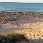
I took this dusk till dawn image of the night sky rotating about the south pole at Tasmania’s most southerly point, Cockle Creek. The site was so dark and so remote that during the entire time I photographed the night sky, not one aircraft passed by and not one stray photon of light pollution illuminated the foreground. If you look closely, you can find some meteors in the image too.
I sat and stargazed under the most pristine conditions imaginable and watched faint wisps of southern lights flickering just over the tree-line.
As described in the previous post, Ballarat was the site of the Eureka Stockade and is now home to a museum dedicated to the history of Australian democracy. I think I should mention that its showpiece tourist attraction is Sovereign Hill, an open air museum and recreation of a gold rush town in the 1850s. Unfortunately, dogs are not allowed in Sovereign Hill and it’s so big you could easily spend the best part of a day there, so we decided to leave this for another time when we could visit together.
After two very hot days in the Grampians, it was now freezing cold and wet anyway.
Looking round for something else to do, I noticed that the inaugural Ballarat Writers’ Festival was on at the weekend. The theme of the festival was democracy. I took the opportunity to go to one of the workshops on crime fiction at the Old Law Courts in town. It was run by local author Dorothy Johnston and was an enjoyable couple of hours discussing crime fiction with some like minded ladies.
The Amazing Mill Markets are well worth a stop where you can find antiques, books, jewellery, art and clothing amongst other things. Jonathan particularly enjoyed the stop as it has a large display of memorabilia from the movie Wolf Creek.
Clunes
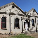
This historic town was the site of Victoria’s first gold strike in 1851 and many of the original buildings line its wide main street. I was keen to visit, as nowadays it’s famous for its many secondhand bookshops and an annual book festival in May. Most of the bookshops are only open at the weekend. I couldn’t find anything worth buying at their overinflated prices though. Ironically, the library had been abandoned.
Clunes
Talbot
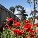
Another interesting and historic town with impressive 19th century buildings indicating its wealthy gold rush past. It also has a privately owned observatory which is open every Friday, Saturday and Sunday on clear nights. Jonathan commented that it was a shame his neighbour at the back has let a large tree grow, blocking the eastern night sky.
Talbot
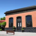
Maryborough
The sun was out again and we instantly felt relaxed at Maryborough Caravan Park which is next to Lake Victoria and within walking distance to the town. We could see why several people had written on Wikicamps that they came for a day and stayed for a week. The only downside is all the ducks which I think remind Winston of our chickens he used to round up.
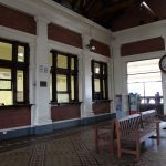
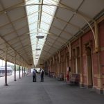
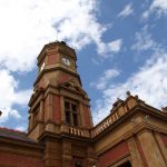
The railway station is huge as Maryborough was seen to have an important central position geographically. Novelist Mark Twain visited the town in the 1890s and famously described it as ‘a railway station with a town attached’.
Maryborough Railway Station
Compare to 1910
After the disappointment of Clunes, we discovered a little gem of a secondhand bookshop in Maryborough run by the Lions Club. All the books are in good condition and most are $1 or $2 with all proceeds going back into the local community. I came away happily with a bag of books.
An iconic Australian road trip and a must do on any international tourist’s itinerary.
The origins of the Great Ocean Road are interesting. Towards the end of the First World War, the Chairman of the Country Roads Board put forward a proposal to the State War Council that repatriated soldiers could be employed to build roads and connect towns in remote areas. Thousands of returned soldiers provided the hard yakka to build the Great Ocean Road with picks and shovels and no heavy machinery. I can’t help thinking that in a way it would have been a good thing for their mental health after the horrors of war.
The route was officially opened on 26 Nov 1932 and for the first few years, drivers paid a toll of two shillings and sixpence. I would happily pay a toll today if it meant the road was maintained to a decent standard.
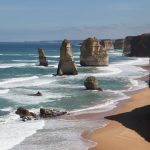
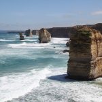
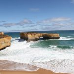
The 12 Apostles (although I think there are only 8 now)
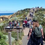
The drive is really all about the section between Princetown and Peterborough where the road hugs the coastline and tourist buses constantly come and go at the 12 Apostles, limestone stacks which have become separated from the cliffs.
A large section from Apollo Bay to Princetown is steep, winding and uneven road through the forests of the Otway Ranges. It was very scenic (although uncomfortable at times) and there was nowhere to stop through the forest section. Tourists had stopped their cars in dangerous spots where there were glimpses of the ocean or they had spotted a koala in the trees.
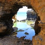
The Arch
The Arch
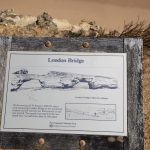
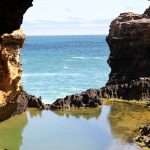
London Bridge
Originally a bridge, but the first walkway collapsed suddenly in 1990, stranding two tourists. This would have been a great story and I managed to find an interview with one of the people stranded which is quite amusing.
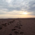
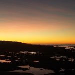
Dog friendly beaches and Jonathan also managed to capture the Southern Lights in a video taken over the course of an hour. We’ll hopefully see them again in Tasmania.
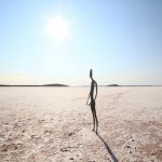
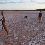
There always seems to be something tempting us a bit further off our planned route. We didn’t regret a trip out to Lake Ballard, a salt lake 51km West of the town of Menzies though. The Perth International Art Festival commissioned sculptor Antony Gormley to create the ‘Inside Australia’ art installation for their 50th anniversary in 2003.
He set up a 3D body scanner in Menzies Town Hall and managed to persuade 51 locals to strip naked in order to have their bodies ‘mapped’ by the scanner. It was one used by the film industry to create animation and special effects. He then used the images to create 51 metal figures which he set out across the huge salt lake. The names of all the residents are listed on the website at www.lakeballard.com
There is a free camping area beside the lake in a beautiful bushland setting with lots of wildflowers and there’s also plenty of shade. It was the most peaceful, relaxing campsite we’ve stayed at so far and we were the only ones there for most of the time. The only amenities are picnic benches, fire pits, rubbish bins, a long drop and a dump point. There’s no phone reception at the Lake.
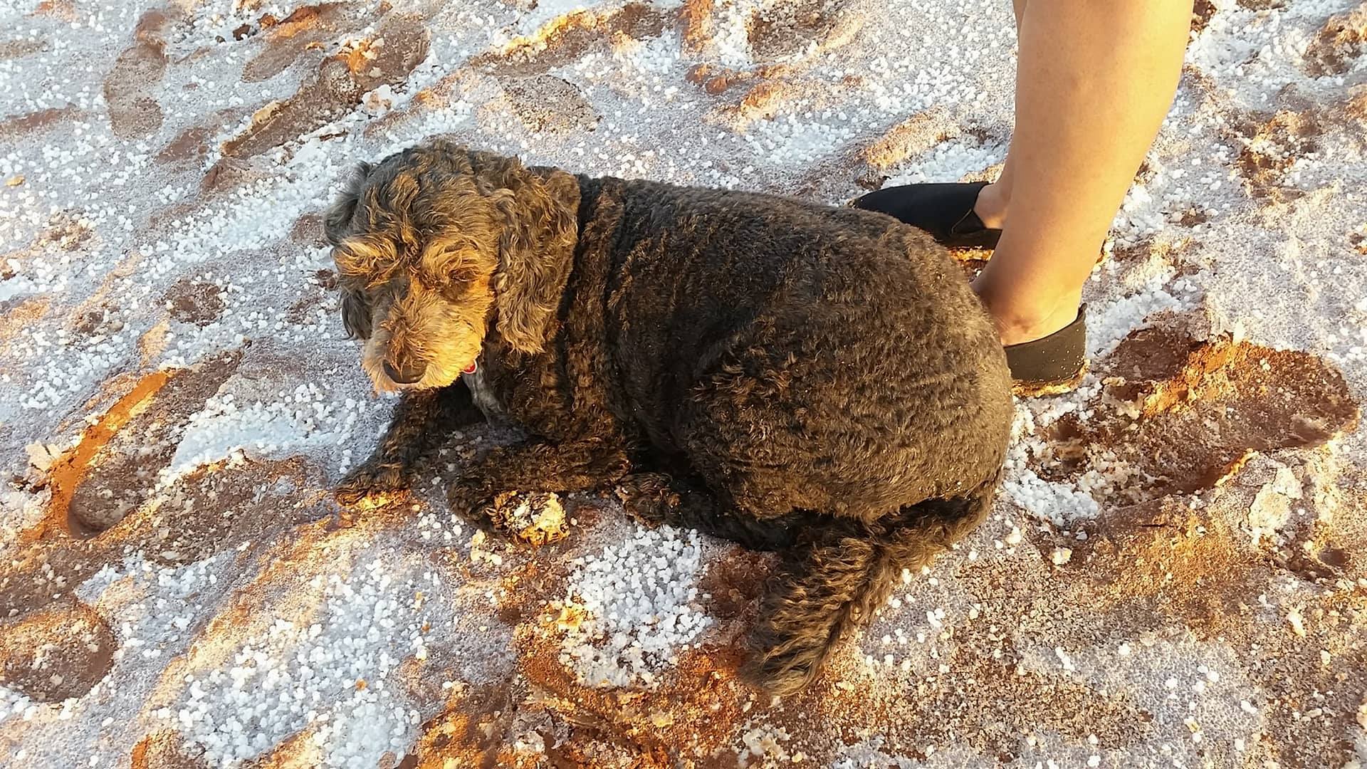
Due to recent rains, the surface of the lake was slippery red mud and quite difficult to walk on. Some visitors had brought some $3 shoes with them specifically to wear out on the lake and leave behind for others. Luckily a pair fitted me which saved my shoes.
Jonathan was keeping his fingers crossed for clear night skies so he could take an astro photo. While the skies weren’t as good as they could be, he still took some impressive photos.
The council are in the process of sealing the road to the lake but the 30km of unsealed road was well graded and not an issue for the campervan. The only downside to the experience were the huge march flies which didn’t seem to be put off by insect repellent.
We mainly stopped off in Carnarvon to restock at Woolies but there were a few touristy things to do.
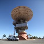
The Carnarvon Space and Technology Museum
The museum was opened in 2012 by Buzz Aldrin and is on the site of the OTC Satellite Earth Station. The station was opened in 1966 and was part of the global satellite communications system. It also relayed NASA communications. The Carnarvon Tracking Station was built to support NASA’s Gemini, Apollo and Skylab programs. It was the largest manned space flight tracking station outside the US.
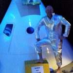
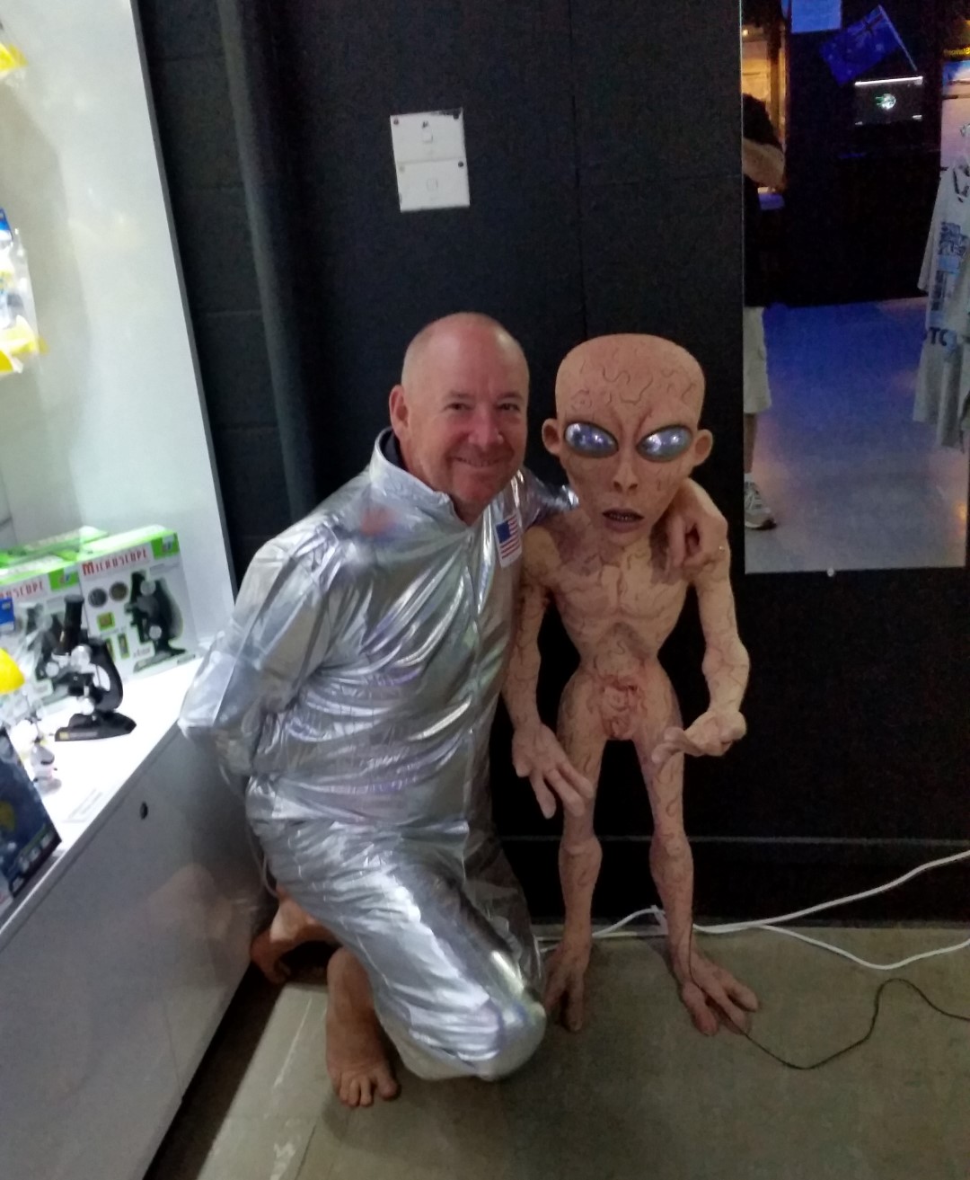
Here’s Buzz Bradshaw and his alien friend having a highly enjoyable time in the museum.
The Fruit Loop
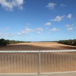
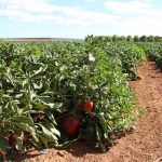
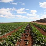
Carnarvon lies on the Gascoyne River and is famous for its tropical fruit and vegetable farms. The plantations get their water supplies from bores below the dry river bed. The river only flows after heavy rains inland. The ‘fruit loop’ is a self drive route around the plantations where you can stop at roadside stalls or farm shops to sample and buy fresh produce.
The Gascoyne River
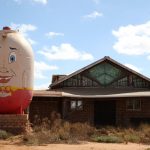
The Big Humpty Dumpty outside what used to be an egg farm
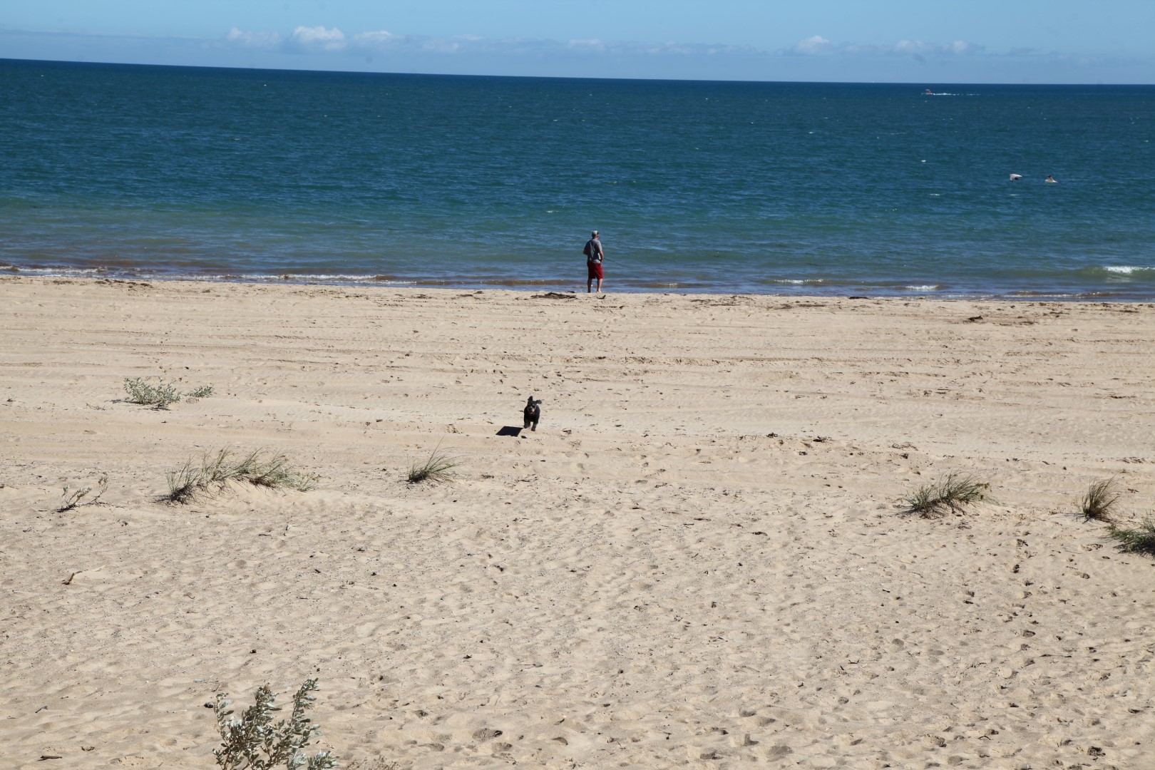
The best beach in Carnarvon is at Pelican Point … and it’s dog friendly.
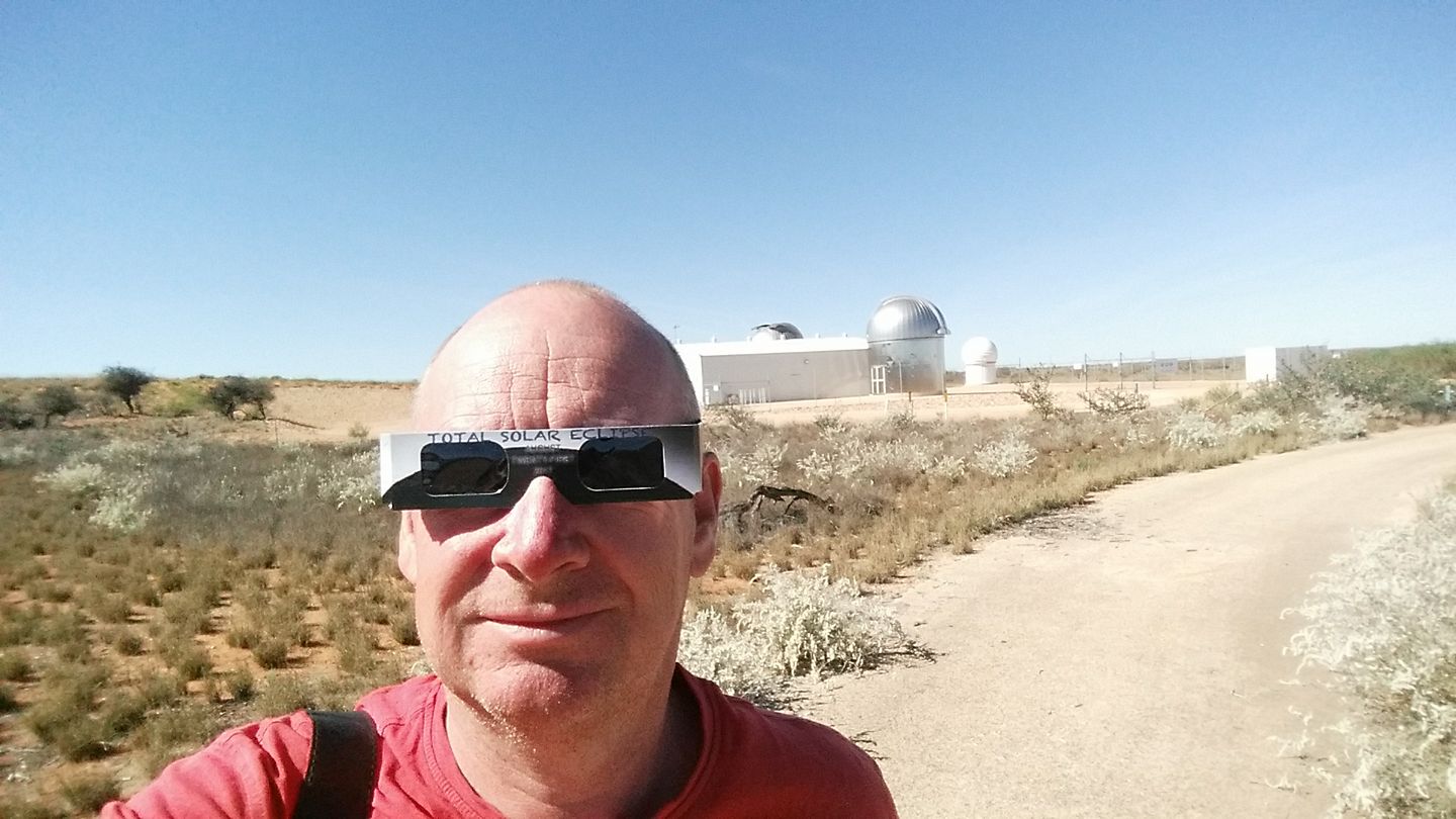
On the way into Exmouth we came across Learmonth Solar Observatory which is a joint operation between the Australian and US governments. Exmouth has a dry climate, with approximately 320 days of sunshine a year, hot summers and mild winters so makes an ideal location. The observatory isn’t open to the public however. In April 2023 there will be a total solar eclipse visible from Exmouth so Jonathan was keen to check out some viewing sites on the path of totality.
Exmouth is at the Northern end of the World Heritage listed Ningaloo Reef. There are lots of campsites along the Cape Range National Park but of course we couldn’t go there because of The Winst. We stayed at the Lighthouse Caravan Park at the North West Cape which suited us very well, as a dog friendly beach is directly across from the campsite. We walked up to the Vlamingh Head Lighthouse where there are sweeping views along the coast and we also spotted humpback whales which are migrating. We could see loggerhead turtles close to shore, feeding on the reef. Emus also came wandering into the campsite.
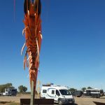
The Big Prawn
Cheeky Emu has pinched a water container from the tent
Jonathan was surprised to find that the sandflats of the Ningaloo Reef Lagoon are famous in fly fishing circles as a place to catch bonefish, trevally, queenfish and permit and he spent a couple of afternoons out with his fly rod.
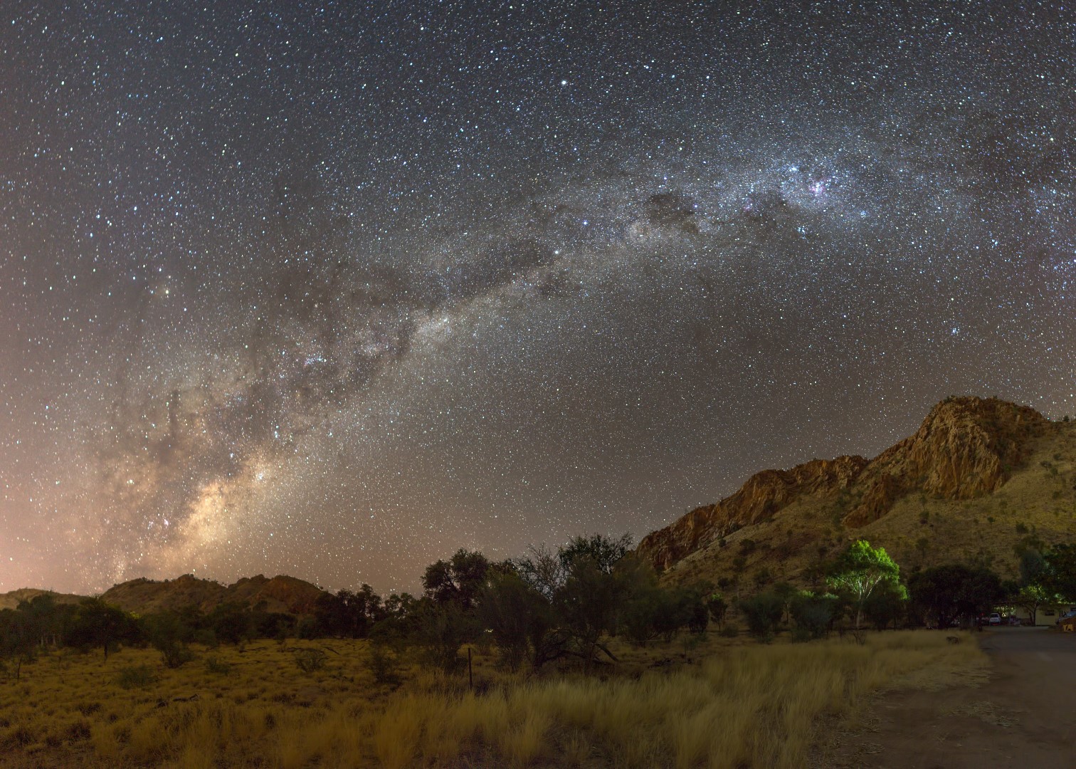
The West MacDonnell Ranges are fantastic for Astro photography. Alice Springs does offer a gentle glow of light pollution, but overall the area is very dark and the magnificent red ranges make for a great backdrop to a nightscape!
Here’s a multi-shot panorama of the range behind us on the campsite with the milky way rising:
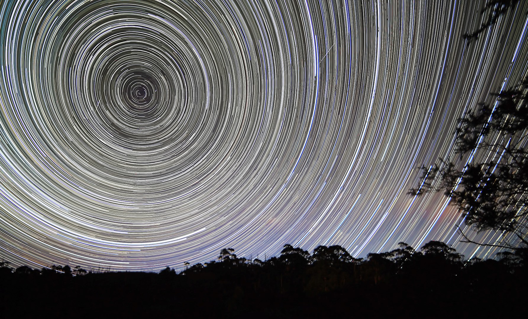
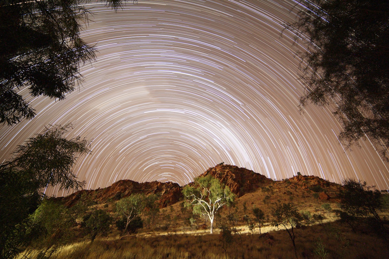
And no stop would be complete without a star trails image taken over two hours whilst we chilled out to a movie!
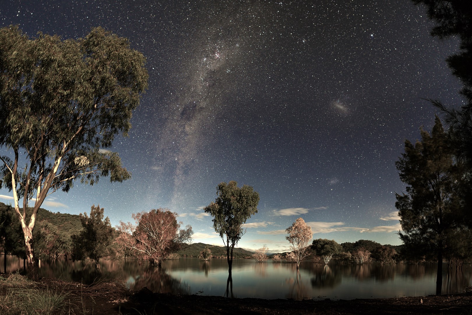
And finally, for my Northern Hemisphere family and friends. As we move further North, it is possible to see old familiar constellations. Alice Springs is on the tropic of Capricorn, several degrees higher than home, and as a result, the whole of the “Big Dipper” manages to peak over the horizon! I have highlighted the main stars to make it clear 🙂
Despite bad weather, the clouds parted over Chaffey Dam last week to let me see a beautiful moon-set behind the dam. It illuminated the trees just perfectly so that I could take this photo (or more accurately a number of photos that I subsequently spent ages stitching into a panorama).
I would never have guessed that I would get a chance to do some nightscape photography tonight, it’s been such a miserable day weather wise. We’ve hidden ourselves away in the van watching movies all day and of course Winston has loved it!
So bizarrely, the clouds seem to have parted and I got a chance to drag the camera down onto the beach which was covered by water on the high tide and take this shot. It’s the first time I have managed to take a shot knee deep in water – maybe I’m getting braver carrying that equipment out into the sea, maybe I’m getting stoopider. You decide 🙂